|
|
HOW TO CLIMB COL DES ARAVIS |
|
|
|
FROM THE SOUTH ?? |
|
|
|
HOW TO CLIMB COL DES ARAVIS |
|
|
|
FROM THE SOUTH ?? |
|
Welcome in another part of "La Route des Grandes Alpes". After having climbed "Col des Saisies" from the South and descended it in the North side, we are arrived in "Flumet". We are still in "Savoie" department and we expect to pass in "Haute Savoie" by "Col des Aravis". This climb avoid us to take the boring main road passing by "Sallanches". "Col des Aravis" is well known by Tour de France and if my information are good, the 2002 edition will climb it to join "Col de la Colombiere" after.
This ride leaves "Flumet", a little village at 940 meters of altitude shown by the green ellipse on the following map. Naturally "Col des Aravis" is identified by the red one. That's enough talking, take the bike or your tandem and go ahead...
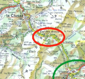
As shown on the map the climb will be 12 kilometers long. But the difference of altitude is only equal to 600 meters. Don't be worried by the climb just after "Flumet", you will have a flat road to join "La Giettaz" where your cycle computer will show you an average speed of 28 km/h. After "La Giettaz", it will write only 09 km/h. Perhaps can you understand why? Are you ready? We exit "Flumet" by the D909 road...
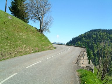
Just after "Flumet", the road is enjoyable. For your information, we are in "Gorges de l'Arondine"...
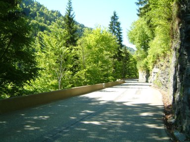
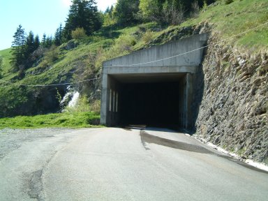
The road climbs gently passing by a few tunnels. The last one shows the beginning of the flat road...
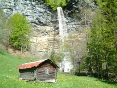
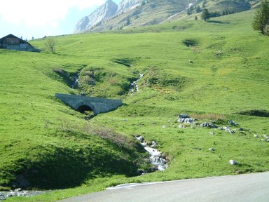
Five kilometers later, I recommend to have a look to this waterfall on your right. It is called "Cascade du Dard" or "Le voile de la Mariée". We are at 1010 meters of altitude...
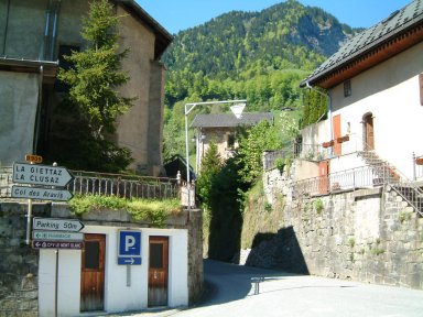
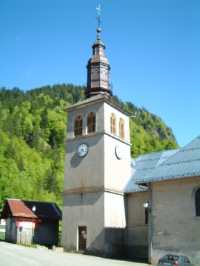
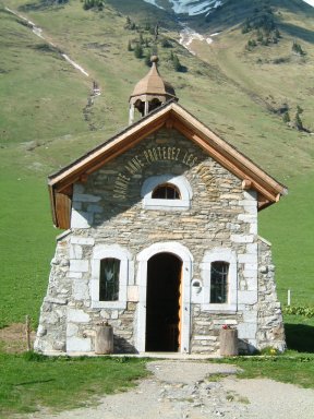
One kilometer later, we arrived in "La Giettaz". You don't have to pronounce "AZ" and just "La Giette" will show you know this area! This little village has a church, protected by "Col des Aravis"...
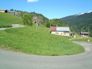
After "La Giettaz", you will have to complete only 6 kilometers of climb to reach the mountain peak. Perhaps you were right to take fresh waters in your bottles. The first bends show the climb will be terrible under the sun...
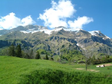
If the climb is terrible, you have to admire the landscape around you. For example, here is shown "La chaîne des Confins". Behind theses mountains, it is "Col de la Colombière". Are you aware of theses places?
If you are preoccupied by the landscape, don't forget to have a look on the road...
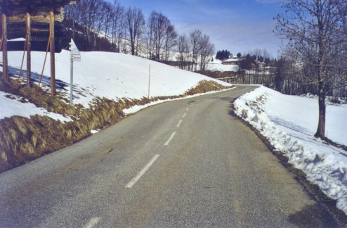
The road becomes tiny and the climb continues through chalets and gites. I took this photo to show it is possible to climb this col at the beginning of spring. We rode it just before our wedding...
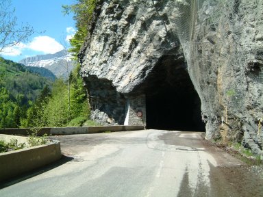
Later, here is a tunnel. It is wet and you will enjoy your mudguards, your fenders to avoid water on your dresses...
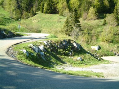
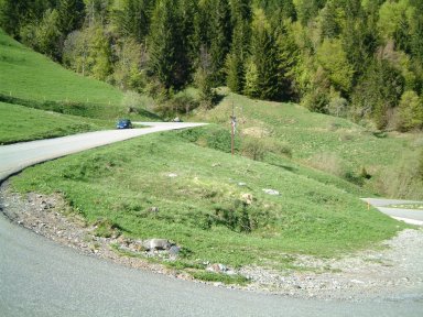
After the tunnel, the climb is not yet finished. You have to pedal. Mountain rides are terrible as shown on this bend...
More and more, the road climbs. But it is not so difficult because you are soon arrived...
The last bend seems terrible because you see the road just over you... Yes, continue to pedal...
If you follow 2002 Tour de France, you will recognize this panel showing you are arrived at "Col des Aravis". Perhaps you feel fresh air around your neck, perhaps a bitter wind if you climb it in winter time...
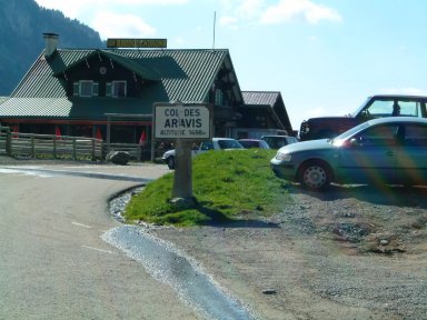
On the previous picture, this place was the last control or checkpoint of the mountain ride organized by FFCT in 1996 and 2000...
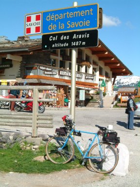
Put your bike against the signpost, have a look on the chapel on your left. Then prepare you for the descent descend...
The descent will bring you in "La Clusaz" and "Saint Jean de Sixt". Now you are arrived in "Haute Savoie" department, a high place to ride in mountains...
|
Did you enjoy this little climb ? |
|
|
This page has been written and composed for your pleasure by Jean-Philippe BATTU in December 2001 |
|