|
|
WELCOME IN HAUTE-SAVOIE TO |
|
|
|
DISCOVER: COL DU MARAIS |
|
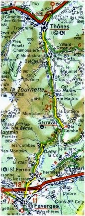
This ride is far from Grenoble. We are in Haute-Savoie (Department 74) at the east of Annecy. From "Thônes", town well known for its cheese called "Reblochon", this ride brings you to Faverges without climbing Col des Aravis. As you are going to discover, this climb is easy. Col du Marais is 843 meters of altitude. We climb from the north side, from "Thônes", as shown on the map:
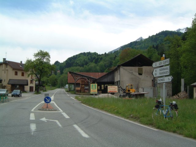
In "Thônes", take the D12 road towards Faverges, on the other side of the "Col du Marais". The first kilometers aren't very difficult but the weather doesn't seem very nice. I hope you brought your showerproof clothes if you don't want to return back home wet! At this crossroad, the road on our left is very steep and joins "Col de la Croix-Fry" after "Manigod". I climbeb it for the first time in 1996's during Lyon-Mont Blanc-Lyon. On the other side of "Col de la Croix-Fry", the road continues towards "La Clusaz" or brings you to "Col des Aravis". It is time to go, let's continue the D12 road...
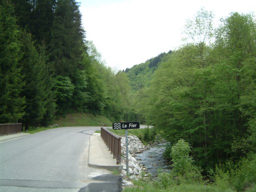
After this place, the road crosses over the little river "Le Fier". You can notice this road is very quiet...
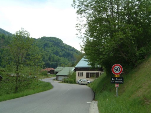
The road continues to climb gently along "Le Chamfroid". We are already in the middle of the climb. Before this village, there is a little climb, but not very difficult...
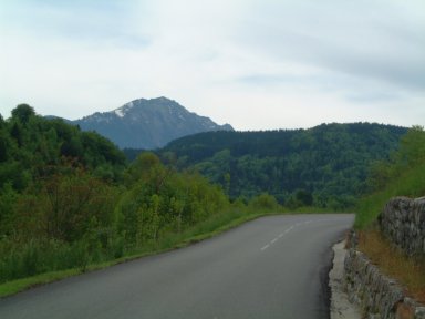
Further, on your right, you will notice "Tournette" mountains at 2351 meters of altitude. There are more and more clouds and you are not yet arrived at the col...

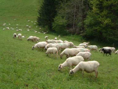
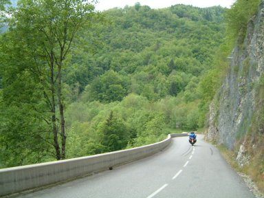
But you are lucky, the climb is easy. On your right, here are some ewes. No problem for them, they are waterproof! Go on climbing, you are close to the top...
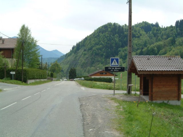
Here is the top of the col with its name and its altitude written on the sign. Perhaps are you going to avoid the shower ?
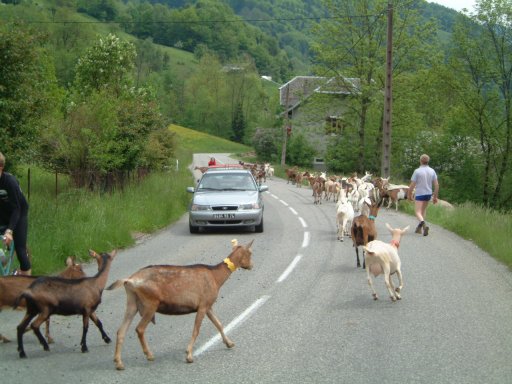
You were aware this road was quiet. Here is a herd of ewes who go back home after the day in the fields. You have to stop! It's a pity to stop in the descent but ewes have priority. On the other side of the road, notice the rider who had to stop in the climb. Far behind him, his pal is coming...
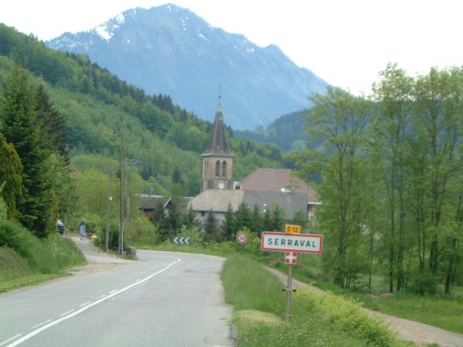
Three kilometers after the Col, we arrived in "Serraval". It is a little village at 763 meters of altitude. From this village, another possibility to join the valley is passing by "Col de l'Epine" on your right. This Col won't be described in this page. It must be ridden before...
After "Serraval", the road continues to descent, but a little climb arrives on two kilometers...
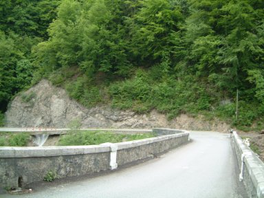
From this point, you enter in a mountain pass with a little river below "La Chaise". The road has been rebuilt in 2000...
On this bridge, you cross this little river "La Chaise"...
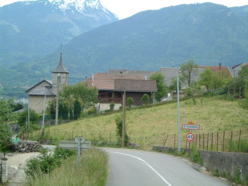
After eight kilometers of descent, we arrive in "Saint Ferréol", close to "Faverges". In the middle distance, you can see "La pointe de la Sambuy" at 2200 meters of altitude...
After "Saint Ferréol", here is "Faverges" on the main road between "Ugine" and "Annecy". In the middle distance, you can see "Col de Tamié", an easy climb from "Faverges". I will tell you about this Col later...

You have been lucky with the weather. During a ride with the bike, you have to learn the weather may change quickly... Be careful with large clouds and bring with you showerproof clothes... I hope you enjoyed this ride...
|
What are your feedbacks about Col du Marais ? |
|
|
Ridden in May 2001 and written by Jean-Philippe BATTU in February 2002 |
|